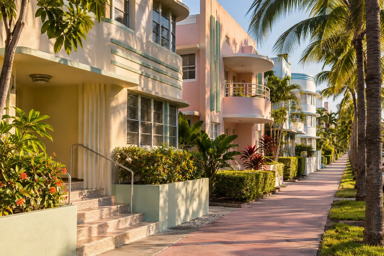
Miami Beach neighborhoods fall into three broad areas running north along the barrier island: South Beach (the urban, Art Deco southern tip), Mid-Beach (hotels, towers and bayfront streets) and North Beach (lower-rise, neighborhood-scale blocks), plus a chain of residential islands in Biscayne Bay. Miami Beach is a separate city in Miami-Dade County, joined to Miami by several causeways, and its population was 82,890 at the 2020 census, according to the U.S. Census figures summarized on Wikipedia. For any buyer, the common threads are tidal flooding and sea-level planning, historic preservation rules, building age, and condominium and cooperative rules, including limits on short-term rentals, that differ sharply from building to building.
Miami Beach neighborhoods at a glance
- South Beach. The southernmost 2.5 square miles of the city and its most urban part. In everyday use the name covers the area from the southern tip, near South Pointe, up to about 23rd Street. Sub-areas include South of Fifth, Flamingo/Lummus, the City Center area and several islands.
- Mid-Beach. The long middle stretch of oceanfront hotels, residential towers and quieter bayfront streets. Names used inside it include Oceanfront, Bayshore and Nautilus.
- North Beach. The northernmost part of the city, more low-rise and residential. It includes Biscayne Point, the Isle of Normandy, La Gorce and North Shore.
- The islands. Star, Palm and Hibiscus Islands, the Sunset Islands, much of Normandy Isle and the Venetian Islands (except Belle Isle) are man-made, created from landfill dredged from Biscayne Bay in the 1920s.
The boundaries between South Beach, Mid-Beach and North Beach are informal and sources draw them in slightly different places, so treat any map as an orientation tool and verify an address with the city. The city's own police department, for example, lists four districts: North Beach, Mid Beach, South Beach and the Art Deco Cultural District, according to the City of Miami Beach.
Character of the area
The city is often described in three broad parts. South Beach, the southern tip, is the most urban, with the Art Deco Historic District, Ocean Drive, Lummus Park along the beach, the pedestrian Lincoln Road mall, Española Way and the Convention Center area. Mid-Beach is a long stretch of hotels, residential towers and quieter streets along Collins Avenue and the bayfront. North Beach is more low-rise and neighborhood-scale, with Normandy Isle and the Normandy Shores area, and public open space near the shore.
Sunset Harbour, on the bay side of South Beach, mixes restaurants, marinas and residential buildings. The Miami Beach Botanical Garden and the golf course near Alton Road offer green space in the middle of the city. The mix of nightlife areas and residential blocks means noise and activity levels vary a lot from one street to the next, so visit at different times of day.
South Beach, Mid-Beach and North Beach compared
- Pace. South Beach is busiest and most walkable; Mid-Beach is quieter and spread out along Collins Avenue; North Beach is the calmest and most residential.
- Typical buildings. South Beach has small Art Deco and Mediterranean Revival buildings next to newer towers; Mid-Beach has hotels and mid-century and modern towers; North Beach has low-rise apartments, townhouses and houses.
- Historic rules. South Beach holds the best-known historic district, and several North Beach neighborhoods were designated historic in 2018, so check any address in either area.
- Single-family option. Houses are concentrated on the islands, in La Gorce and in parts of North Beach rather than in the oceanfront strip.
The Art Deco Historic District
The Art Deco Historic District in South Beach is bounded roughly by the Atlantic Ocean on the east, Lenox Court on the west, 6th Street on the south and Dade Boulevard along the Collins Canal on the north. It was added to the National Register of Historic Places in 1979 and contains hundreds of hotels, apartment buildings and other structures built between 1923 and 1943. The National Register listing itself did not protect buildings from demolition, so check whether a specific property also sits in a local historic district with its own review rules.
Housing types you will encounter
- Art Deco and Mediterranean Revival buildings. Small apartment buildings and hotels, many converted to condominiums, often inside local historic districts.
- High-rise and mid-rise condominiums. Oceanfront and bayfront buildings from several decades, plus newer luxury towers.
- Single-family houses. Found in the Sunset Islands, Palm, Hibiscus and Star Islands, the Venetian Islands, La Gorce and parts of North Beach.
- Townhouses and low-rise condos. Particularly in the interior blocks and North Beach.
Getting around
Four main routes connect the island to the mainland: the MacArthur Causeway, the Julia Tuttle Causeway, the Venetian Causeway and the 79th Street route in the north. Traffic on the causeways is heavy during events, holidays and peak season. Within the city, Miami-Dade buses and the city's trolley service run in several parts of the beach, and bike-share stations are common, though schedules and routes change. The southern part of the city is genuinely walkable, while farther north most people rely on a car. Miami International Airport is on the mainland, a short drive from the beach.
Schools and public services, in general terms
Public schools belong to Miami-Dade County Public Schools, and attendance zones should be verified on the district's boundary tools. The city has its own police and fire departments and runs parks and the public beach front, including its stormwater program. Rules on construction, noise and short-term rentals are set by the city and vary by zoning district, so check them for the exact address.
Flooding and elevation
Miami Beach has been publicly working on flood resilience, including pumps and raised roads in some neighborhoods. That work reduces some street flooding, but it does not change a given property's FEMA zone or insurance picture. Low-lying streets can flood during king tides and heavy rain, and ground-level garages and lobbies are particularly exposed. Because parts of the islands are man-made landfill, check elevation and flood history for the specific street rather than the neighborhood as a whole. Read the flood zones and insurance guide before you rely on any assurance.
Things to check before buying
| Item | What to look for |
|---|---|
| Historic district status | Properties in local historic districts need review for exterior changes, which affects renovation plans and costs. |
| Building age | Many buildings are old enough that milestone inspections and reserve studies matter. Read the condo guide. |
| Short-term rental rules | Both city zoning and the association's own documents can prohibit or limit rentals. Do not assume a building allows them. |
| Flood zone and insurance | Check FEMA maps and get insurance quotes before the inspection period ends. |
| Seawalls and docks | For waterfront houses, confirm the seawall height, condition and permits. |
| Special assessments | Ask about planned or recent assessments and the state of reserves. |
Close neighbors and other communities nearby
North of Miami Beach, the barrier island continues into Surfside, a smaller town with its own character, followed by the village of Bal Harbour and the tower-lined Sunny Isles Beach. On the mainland side, Downtown Miami is a short trip across the causeway and offers a very different urban setting. If you are still deciding between counties, the Palm Beach County and Miami-Dade comparison covers the wider picture. For the homestead rules that apply if you plan to live here year-round, see the homestead guide.
This guide offers general orientation, not advice about any property. Always verify zoning, flood zone and association rules with the city, county and licensed professionals.
Frequently Asked Questions
What are the main neighborhoods in Miami Beach?
The three broad areas are South Beach, Mid-Beach and North Beach, from south to north. Within them are smaller districts such as South of Fifth, Flamingo/Lummus, Sunset Harbour, Normandy Isle and La Gorce, plus residential islands such as the Sunset Islands and Venetian Islands.
Where does South Beach end and Mid-Beach begin?
There is no single official line. South Beach is commonly described as running from South Pointe to about 23rd Street, with Mid-Beach continuing north of it, but sources and locals draw the edges differently. Use the specific address, not the neighborhood label, when checking zoning or flood information.
Is Miami Beach part of the city of Miami?
No. Miami Beach is its own city on a barrier island, with its own government, police and fire services, though both are in Miami-Dade County.
Which causeways connect Miami Beach to the mainland?
The MacArthur, Julia Tuttle and Venetian causeways, plus a route along 79th Street in the north. Congestion varies with events and season.
Can I rent my Miami Beach condo short term?
It depends on city zoning and your association's documents. Many buildings restrict or prohibit short-term rentals, so read the declaration and ask the city.
Does the city's flood work remove flood risk?
No. Pumps and road elevation help with street flooding, but each property still has its own FEMA zone and insurance requirements.
What is the Art Deco Historic District?
It is a designated area of South Beach with many preserved 1920s to 1940s buildings, listed on the National Register of Historic Places in 1979. Exterior changes in such districts go through preservation review.